Is it possible that there is a group of Indonesian islands that ‘technically’ still belong to Spain due to an odd historical plot? And that these islands also hold some of the most stunning diving sites on the planet beneath it’s crystal clear waters?
I learned about these islands for the first time in 2019. A friend from Singapore informed me: “Did you know that there are some Indonesian islands north of Papua that are ‘technically’ still Spanish?”. And, in addition, “Do you know they offer an exceptional diving experience?“. My curiosity was sparked by these two statements, which inspired me to learn more about the location and its past. I was more and more fascinated as I studied. The “Indonesia Outermost Islands” are the farthest islands in Indonesia. They are far away, hard to reach, and defended by the military. Which could mean that the reefs are protected from poachers. We had to go explore!
Is it possible that there is a group of Indonesian islands that ‘technically’ still belong to Spain due to an odd historical plot? And that these islands also hold some of the most stunning diving sites on the planet beneath it’s crystal clear waters?
This combination of historical mystery and unparalleled natural beauty, located in the most remote reaches of Indonesian territory, made us decide to contact the owner of a traditional Indonesian boat to start preparing the expedition to Mapia.
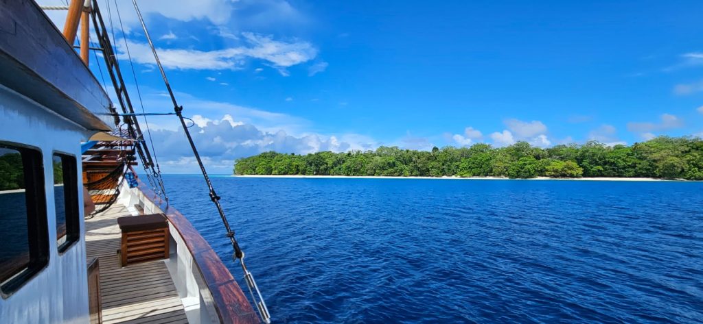
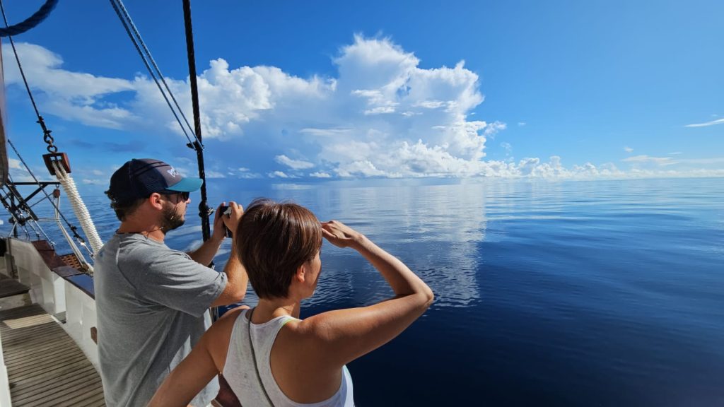
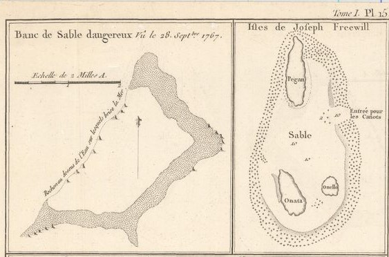
In 2020, our aspirations to explore the Mapia archipelago were interrupted by the relentless global pandemic. However, this setback did not stop us. We knew that, sooner or later, we would fulfill our dream. Three years after that initial conversation, on our second attempt, the long-awaited day finally arrived: September 5, 2023, marked the commencement of our journey to the Mapia Islands, also known as Kepulauan Mapia in Indonesia. In ancient times, these islands were referred to as Guedes Island, “The Freewill Islands,” and St. Petersburg. The story of their historical names will be saved for a later part in this article.

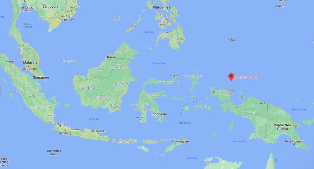
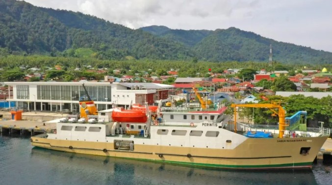
As we prepared for the expedition, we had to take into account that, the archipelago’s isolated location is the farthest point of Indonesia’s island chain. With Papua to the south, the Papua New Guinea Trench to the east, and Palau and the Philippines to the north, we were positioned along the equator in the enormous Pacific. Making it important to check the weather and any potential storms that would disrupt the trip. After conducting, doing a lot of research and making contacts at the ports of Manokwari and Biak, I was fortunate enough to get in touch with Pak Irja, who works as a port agent in Biak. He gave me the captain’s contact details for the Perintis, a ship that sails to Mapia once a month. This boat carries essential goods and provides medical assistance to these remote and isolated islands within the Indonesian archipelago.
The word “perinetis” means “pioneer” or “initiator.” The Indonesian government provides financial support for this fleet of ships in order to transport basic supplies and medical aid to isolated and distant islands across the huge Indonesian archipelago. September and May were the best months to travel, the skipper said. But he did warn us that he could not promise a calm sea. However, we decided that September would be the best month to start the journey.
The owner of the boat, Ricard Buxo, contacted other boats and acquaintances to find out about local dive spots and any restrictions. As was already mentioned, there is a military presence. We learned from our experiences in other regions of Papua that the people here are especially protective of their seas and territory. Therefore, we needed to take into account; sailing hundreds of miles only to be denied entry would not be a viable option.
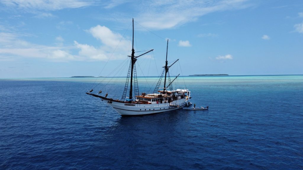
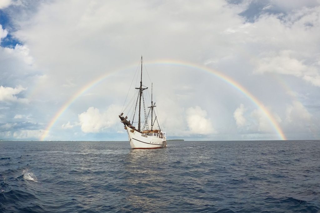
The trip started in Sorong, the capital of Papua’s new province Barat Daya. We boarded the traditional wooden Phinisi boat, SMY Ondina. These Indonesian boats are unique because of their huge, high sails and their two “Kemudi Samping” side stabilisers. Which were once also used as steering mechanisms and allow the boat to have a noticeably low depth. On the picturesque island of Matang, south of Sorong, we spent the first day inspecting our diving gear and cameras.
On this small island we were able to see how children learn the art of fishing from their parents. After analyzing the currents, we chose our entry point and plunged into the crystal clear waters. We went down a coral slope that goes from five to twenty meters deep, where the sandy bottom is dotted with large rocks populated by fishes of all colors. Some rocks were covered with glassfish, among which a couple of leaf fish hid, though not well camouflaged enough. Besides the hundreds of fish, we were able to admire several octopuses and Wobegon sharks. An hour later, and after checking that all the equipment was in perfect condition, we were ready to set sail for Mapia.
On the second day, after sailing 75 miles, we came to a group of islands known as Meossu Island and Pulau Su. The Dutch called these; Pulau Amsterdam and Middelburg. Our dive was in Pulau Amsterdam, where local fishermen told us about World War II ship wrecks in the area. According to what we were told, there are several secret places, but they would only give us the location of one of them. After doing several searches, we found the silhouette of one of the boats and marked the position to start the dive. At 7 a.m., with perfect light and a light current, the conditions were ideal for a spectacular dive. We jumped into the water one after the other and descended to a 15-meter bottom. Here we could make out not one, but several LCMs (Mechanized Landing Craft). These ships were used to land tanks, soldiers, and vehicles on land during the war. One of these ships, which was about 40 meters deep, was virtually intact
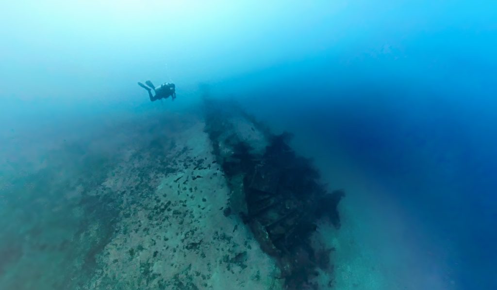
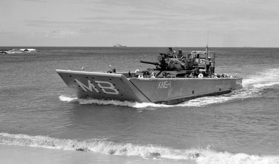
Floating thirty meters above the ship, I couldn’t help but think of the aftermath of World War II. The Americans transported so much equipment to combat the Japanese forces, who maintained a base in Nunfor. This base is located north of Papua’s capital, Jayapura, some hundred miles to the east. After winning the war, the Americans purposely sank these LCMs at sea and withdrew from the region. Exposure in this location seemed, thanks to the Netflix documentaries, like being overwhelmed by history and it feels like you being inside one of those shows. The dive itself is fantastic, not just because it feels like you’re in an underwater museum but also because there are thousands of gorgonians, soft corals, and big schools of parrotfish, batfish, yellow snapper, and barracuda living among the remains of the LCMs. Bearded carpets, Wobbegon sharks, and several spotted rays sheltering on the sandy bottom were also visible to us. After finishing 3 quick dives, we began our longest travel. Covering 160 kilometres in nearly a day without a break to reach our expedition’s long-awaited destination, Mapia Atoll.
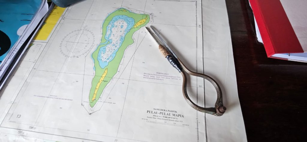
On September 7, 2023, 5.30am, we woke up to the sound of birds flying over the boat, as if they were welcoming us and letting us know that the mainland is nearby. We are about 30 miles from the atoll and we are starting to see the silhouettes of the islands. Our plan is to head directly to Bras, which is a border area of Indonesia and hosts a military base. As we approach the atoll from the east, we can clearly make out the group of five islands. The southernmost island of the atoll is Pegun, which is long and narrow. To the northwest, we have Fanildo with an extensive line of coconut palms, almost connected to the smaller Fenildo Kecil. To the east, we find Bras and Bras Kecil.
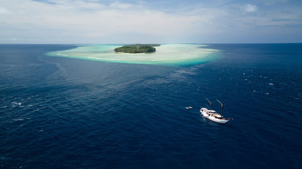
As we approach Bras, a military radio broadcast cuts through the silence of the waters. They ask us to confirm our intentions and warn us that, before carrying out any activity, we must present ourselves to them at the base. In addition, they tell us to use the dock located inside the atoll, a fact that we were completely unaware of. To access Bras, the correct route is through a small canal located on the west side of the atoll, but we were already on the northside of the island! Determined to explore all the options, we lowered the zodiacs and headed towards the island from the north side. However, the tide was too low. The corals emerged dangerously close to the surface, and the waves crashed over them. Our attempt to approach the base from that side proved in vain. We implemented plan B: since access from the north side was impossible, we returned to the ship and followed the instructions of the military, heading to the west side of the island. There, we enter the island through a channel that, at its widest point, measures 200 meters, extending almost two kilometers in length. At its shallowest point, the channel is approximately 2.5 meters deep. Since the Ondina has a draft of 2.6 meters, our captain discarded the idea of spending the night on the island. This channel leads us to the interior of the Lagoon, a vast expanse of water that at some points reaches a depth of 40 meters.
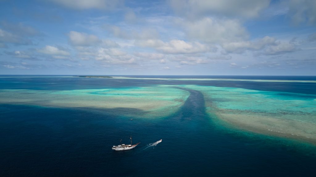
The exceptional marine life found in this lagoon have adjusted to the mild currents and sediments. Coral fish larvae seek sanctuary in its waters, and large groups of rays come together in the sandy sections, hunting crabs. While we were searching for the channel entry to the west of the atoll, a large wooden canoe suddenly approached us. At first, we assumed they were fishermen, but as the Ondina’s captain looked through his telescope, he was shocked to discover that, instead of fishermen, these were military troops heading in our direction. Without pausing, the skipper gives the order to stop the ship. We remained still as we awaited the soldiers’ arrival. After one minute, the soldiers arrive, take a reconnaissance tour around the Ondina and eventually tie up to our side.

Nine Indonesian navy soldiers decided to follow us and observe what we were doing in the region after noticing our change in direction. There’s a noticeable tension in the air. I quit snapping pictures and filming because I’m being careful. The soldiers embark, clothed in their uniforms, some holding SS1 assault guns. But within seconds, we find that the majority them are grinning and very are kind. They instantly ask whether we need anything. The military asks for the passenger list and whether we plan to dive after we board. They even gave us tips on where to get fish after we gave them the list. 😊 We gave them some fuel and shared some cigarettes, coffee, and sugar with them. They tell us we can stay here without any issues, and they do it with a friendliness that surprises us. As they greet us with an invitation for departure and mention to inform them immediately if there is any issue. I kept talking with one of them, a Makassar native, who informed me that battle cannons can be found on the island of Pegun during low tide. That’s one more treasure on our list to find! 😊

After the military took off and granted their approval, we got ready for our first dive in Mapia. We already knew that the mouth of the channel was a great place to dive because of an article about a prior trip in Mapia written by Dr. Mark Erdmann. We started our journey there for that reason. Fede, the Ondina’s cruise director, and I were so excited that we were unable to contain it. Equipped with goggles and fins, we jumped into the water to snorkel and anticipate what awaited us on the bottom. And it certainly was worth it!
We saw midnight snappers, barracudas, dozens of groupers, and enormous schools of big eyes trevallies from the surface. Everything seemed to point to an amazing dive. After that, we fully submerged along with our cameras, dive computers, and oxygen tanks. Nothing could possibly fail. We had been looking forward to this moment for three years: diving in Mapia!
At a depth of fifteen metres, we dove into the channel and made our way to its mouth. The seafloor spread out in front of us like a white sand river with scattered rocks; surgeonfish, snappers, and several species of groups lived in each of these groups. Fish darted out from their hiding spots and swam fast to find another crack in which to hide as we dove from rock to rock. They were everywhere. They had gathered for mating there during breeding season. We had the fortunate to witness a remarkable moment. We saw that the number of groupers gradually dropped over the day, and on our final dive in the channel, they almost entirely disappeared.

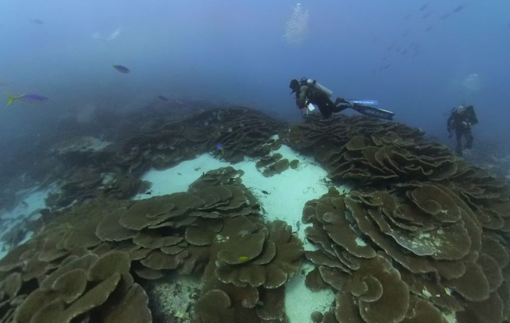
Along with the big groups of jacks and barracudas, we also spotted two marble rays, whitetip sharks, and two ghost pipefish hiding next to a little rock. Thankfully, there wasn’t much current, so we could extensively explore a few places and prepare for the following dives. We discovered that when the current is higher, it is best to dive down farther and allow yourself to get swept along with the flow, having a pleasant drift, and then to spend as much time as you can near the channel’s entrance, where the fish gather. As soon as the current enters the lagoon, it is best to jump off the south side of the channel’s mouth and attempt to reach the deepest area, which is approximately 35 metres deep.
We did a lot of diving on the atoll’s many sides over the span of the next five days. Even though the majority of the days started out bright and breezy, there was always one side of the water that was more quiet and another that was more open to the swell. Our ability to dive on either side of the atoll was made possible by the unique triangular shape. Given the excellent sea conditions, the plan for the second day in Mapia was to explore the west side of the atoll, which is the side that is most exposed. We sail through Pegun’s southernmost point in order to do this. The reef ridge stretches in the direction of the island for over a kilometre beyond it. Sailors can detect the presence of this island by its big lighthouse, which is present on all major islands. We circle around the island and travel west of the atoll. Fede, as with every dive, goes off in a zodiac, equipped with his mask and fins, and heads to the reef area to find the best point for getting into the water. Naturally, what you are searching for are places with healthy coral, fish, and topography that suggests it may be a good place to dive, such a reef ledge that is exposed to currents.
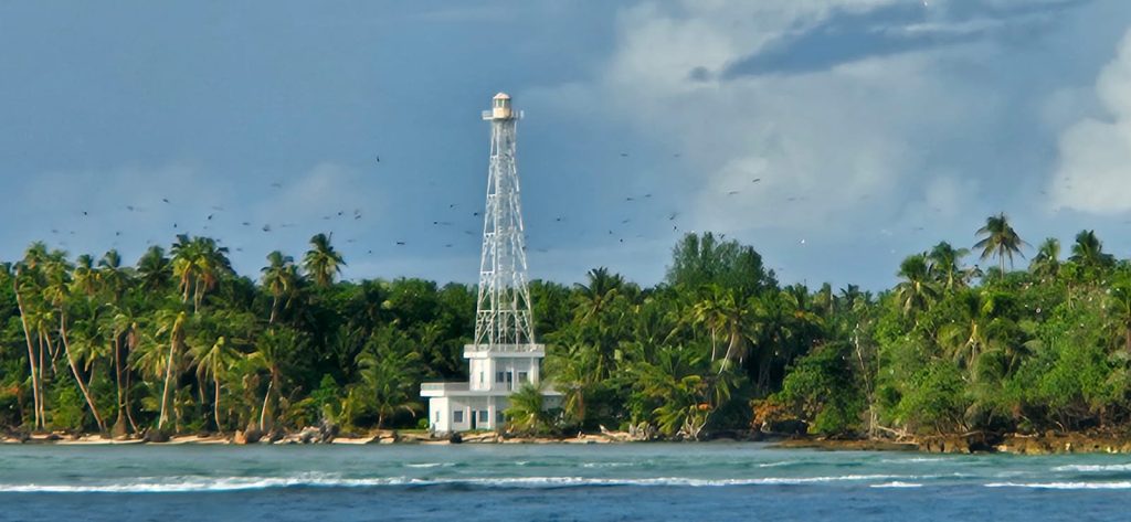
It’s not a wall; it’s a steep slope. The first half hour was a bit dull, little happened, just a seaweed-covered incline. However, the seaweed slope soon filled with enormous gorgonians, some of which were as long as four metres (the divemaster compared him to a gorgonian!)… More and more Gorgonians, one after the other. Gorgonians are known for their frequent currents, but their size also indicates that the currents are not particularly strong, which is the case at the moment. A little while later on, the current started, bringing thousands of vibrant fish with it. More than a dozen green turtles, young grey sharks have all been spotted while making the safety stop. We see that the reef is only 1 meter deep, which means that, if there were no waves, it would be a paradise for snorkeling.
In between dives, the group creates a schedule for the journey, while playing a variety of board games, such as Backgammon, Rubik, cards, and sharing stories on all we have seen.
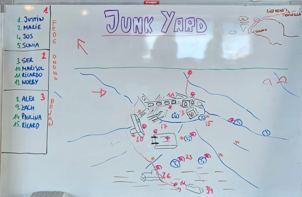

Our quest for dive locations led us to the southernmost point of the atoll, where the reef is broken by both upward and downward currents. And it was amazing! We saw some jacks circling as soon as we got into the water, and some barracudas approached us with curiosity. I saw cold water splashing in, a sign of shark activity, as I dropped to a depth of 35 metres on this rough coral slope. As expected, a large grey shark surfaced from the depths, observed me, and then vanished. We observed big schools of rainbow runners on the vibrant, robust reef, and a fearless dogtooth tuna, measuring over a metre in length, came close to us. The turtles in this area were also very friendly, indicating that it is an area with little human contact. The current carried us to the southern tip of the reef, where I felt like I was in an aquarium with hundreds of fish of all varieties, turtles, jacks and more. It was a memorable dive!
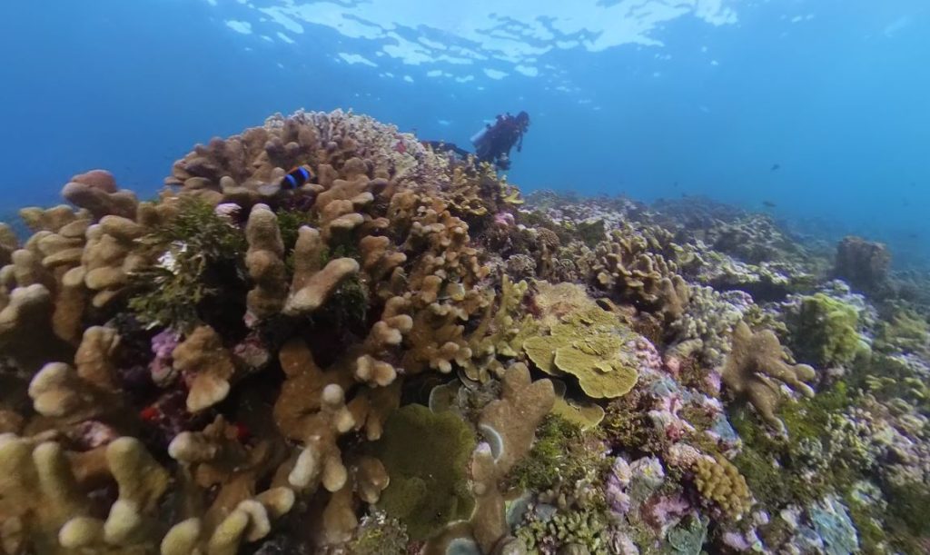

The next day we snorkeled in the northwest part of the atoll and it was fantastic. Along with many other species, we observed groups of surgeonfish, rainbow runners, big eye trevallies, snappers, parrotfish, and batfish. We observed mantas jumping out of the sea, so we know they live here. Dives were more typical at the atoll’s side regions where the current is weaker. Along with red corals, the atoll’s abundant population of green algae, which vary in species based on depth, creates a special ecology. Group member and expert on algae Ricardo H. took pictures of the variety of algae for his lab work. With some walls that drop from the surface to a depth of 30 to 40 metres and then below to over 800 metres, the majority of the atoll in Mapia is sloping. The thing that fascinated me the most, in my opinion, was seeing species that are uncommon in other regions of Indonesia. Like the Ornated Leopard Wrasse, Flame Angelfish, Twin Spines Angelfish, and East Indies Parrotfish. Large groups of Jack, Rainbow Runners, and Green Turtles that we observed on practically every dive of algae and took pictures of with him to examine in his lab, however, were what really impressed me.


We made the decision to travel to the Mapia Archipelago’s main island today. We reach the small community after entering via the lengthy pier that spans the coral reef ridge. The village is roughly split in two: the north side with Indonesian Naval Base and the south side with the village that has about 200 inhabitants, mostly children and the elderly.
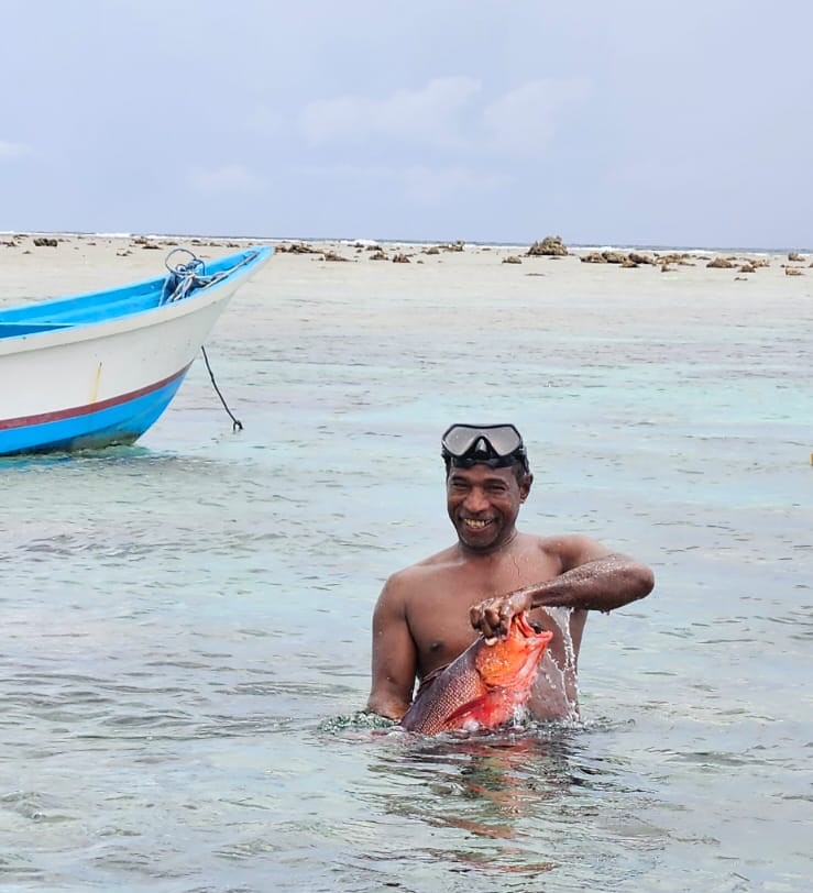

Many people work on Biak Island, a day’s sail away, and leave their grandparents and children in Bras. Everyone was extremely friendly, from the military, who told us that they do one-year shifts and then change. They had been there for 3 months and they guided us through the village. It seemed they were in preparation, as the next day there was going to be a visit from the Minister of Social Affairs. They were getting the town ready to receive her with large posters with the faces of the minister and the Bupati of the area. Journalists interviewed the island’s mayor, and a group of women cooked for a large number of people.


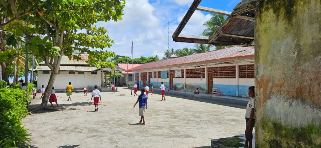
There is a small clinic with a nurse from the island of Flores in charge, and a primary school, where children go until they are about 12 years old; then they will have to go to Biak to continue their studies. The teachers also take turns every 3 months, they change, coming from other areas of Papua such as Biak, Manokwari, Jayapura or Sorong. Although many were born in Bras, none of them are descendants of Bras; it seems that the last of the Mapia aborigines died out at the beginning of the 20th century, taking with them the unique language of Mapia, and leaving only Bahasa Indonesia and other Papuan dialects.
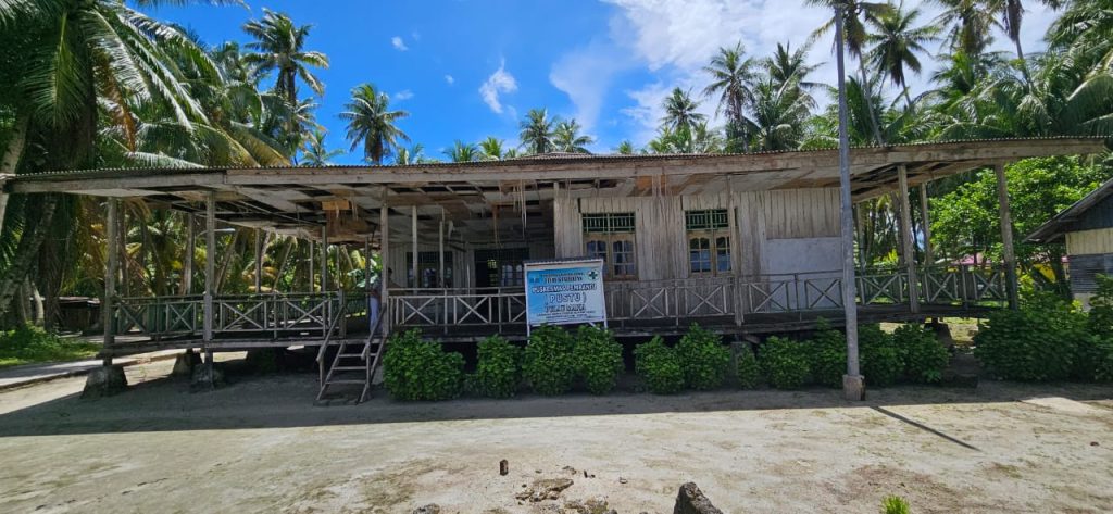
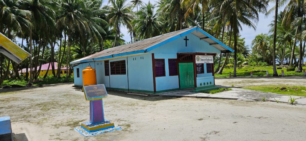
On the seashore, they had many fish drying up, the main diet of the island’s inhabitants: rice and fish. The main business is the sale of copra, which is the skin with the tough flesh of coconuts that is mainly used to extract coconut oil. That, along with a bit of fishing, are the island’s main sources of income.


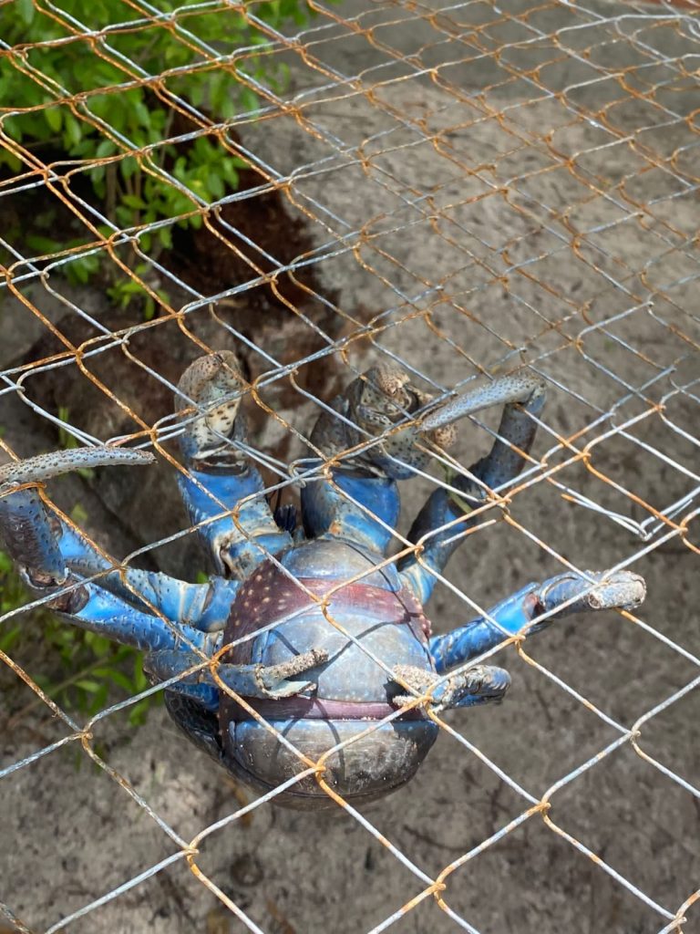
The children, on the other hand, did not stop playing football and other indigenous games; There were no electronics to be seen anywhere. It reminded me of our childhood, playing with everything that the street provided us. 😊 They had a couple of cages with coconut crabs and birds, which resembled the island’s mini zoo. Additionally, there was an area where they protected turtle eggs until they hatched and subsequently released the turtles into the sea.


We continue our walk through the picturesque village and come across a monument that captures my attention: a commemorative plaque and a large rusty missile on top. In Japanese, it reads “Monument to Eternal Peace and Friendship.” This finding leads us to reflect on the rich history of these islands, marked by conquests and conflicts.
These lands were initially discovered by the Spanish, with conquistadors Hernando Grijalva and Alvarado arriving in 1537 and naming them the “Isla de Guedes“. In the late 19th century, following Spain’s defeat by the United States, Spain opted to sell its last possessions in the Pacific to Germany for a considerable sum. However, Germany lost these islands in World War I, and eventually, Japan occupied them. But, abandoning them after World War II when the United States assumed control. These lands also had a brief Dutch colonial membership under the Dutch East Indies.
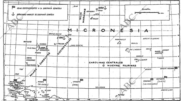
Most surprising is the anecdote discovered by Emilio Pastor in 1948, which suggests that technically these islands are still Spanish. In the agreement for the transfer of Pacific islands from Spain to Germany in 1899, Spain forgot to mention some islands, such as Guedes (Indonesia), Coroa (Marshall Islands), Ocea (now submerged) and Pescadores (Micronesia). Despite Spain’s official declaration in 1949 that these islands no longer belong to it, this issue has been the subject of debate. It even reached the Congress of Deputies in 2014, where Spain reiterated that in 1899, it surrendered all the islands it possessed in the Pacific, whether named or not.
Our expedition in the middle of nowhere has led us to discover another wonderful place in Indonesia, steeped in history, inhabited by friendly people and with exceptional diving opportunities. Without a doubt, this trip through Indonesia will be unforgettable.


The history of conquests and wars has left a rich cultural heritage on the islands, which is reflected in the monuments, customs, and languages that are spoken. The Spanish, German, Japanese, and Dutch presence has left indelible marks on the history and culture of these islands and has contributed to creating a unique and diverse society. During our expedition, we were able to see firsthand how these historical influences have shaped life on Mapia Atoll. The inhabitants of the island have a simple way of life, with rich in traditions and customs that have been passed down generations. In addition, Mapia Atoll is a diver’s paradise. With its crystal clear waters, healthy coral reefs, and abundant marine life, it’s a place not to be missed. But, as I mentioned before, getting to Mapia Atoll is not easy. It is in a remote location and there are no direct flights nor ferry connecting it to the rest of Indonesia. However, if you’re willing to put in the effort, I assure you that it will be worth it.

I hope this story has inspired you to explore the most remote corners of our planet and discover the rich history and culture that surrounds us. If you ever decide to visit Mapia Atoll, don’t hesitate to contact me. I will be happy to help you organize your trip and share with you all the secrets of this magical place.
Based in Ubud
Village life activity
Jatiluwih rice fields
Cepung Waterfall
Tanah Lot Temple
5 nights in Ubud
3 Nights stay in Seraya
3D2N Borneo Orangutan Tour based with private klotok
Travel with transfers included
Island of the Gods
Different hotels each night
Lovina dolphins
Kintamani
Tenganan Village
Besakih Mother Temple
6 nights in Ubud
2 nights in Nusa Dua
Travel with transfers included
Island of the Gods
5 nights in Ubud
3 Nights hotel stay in Nusa Penida
3D2N Borneo Orangutan Tour based with private klotok
Travel with transfers included
Island of the Gods
4 nights in Ubud
3 nights in Uluwatu
1X Half Day Tour Uluwatu and Kecak Dance
Travel with private guide
Island of the Gods
SHARE THE POST WITH FRIENDS
What a awesome article it is really enjoyed my friend, would love to visit this remote island of Indonesia which is situated in the Oceania side of Indonesia in the near future.
BTW can i know the email id of the person who have published this article as i am unable to send email directly from the above link which he mentioned on top.
Thank you & Best Regards.
Arshad Khan
Hello Arshad, thanks for your comment. You can contact Norberto directly sending an email to [email protected]
Safe trips!